Grassland - Vegetation Types and Productivity
Vegetation Types and Productivity
Data are available for vegetation type, herbaceous net primary productivity (NPP), herbaceous NPP trends, and herbaceous NPP deviation from what would be expected based on weather alone.
Remote-sensing derived, CONUS-wide grassland data for various vegetation type and health metrics. Data are currently available for the years 2015-2021. The vegetation health data are available at the watershed (HUC8) and Crop Reporting District (CRD) geographic scales.
Explore the Vegetation Types and Productivity
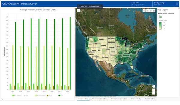
Vegetation Types
Annual average plant functional type (PFT) by HUC8 and CRD for years spanning 2015 to 2021.
PFTs include: Annual Forbs & Grasses, Perennial Forbs & Grasses, Shrubs, Trees, and Bare Ground.
View Data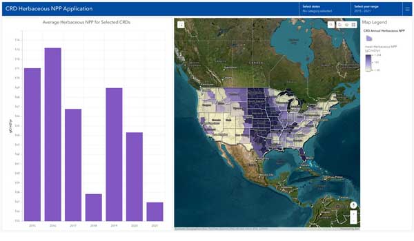
Herbaceous NPP
Herbaceous Net Primary Productivity (NPP) by Year and HUC8 or CRD from 2015-2021.
This data provides the mean herbaceous NPP (gC/m2/yr) for HUC8 and CRD spatial units. The spatial average of total annual net primary productivity for each HUC8 and CRD is calculated using the summation of perennial and annual grassland NPP.
View Data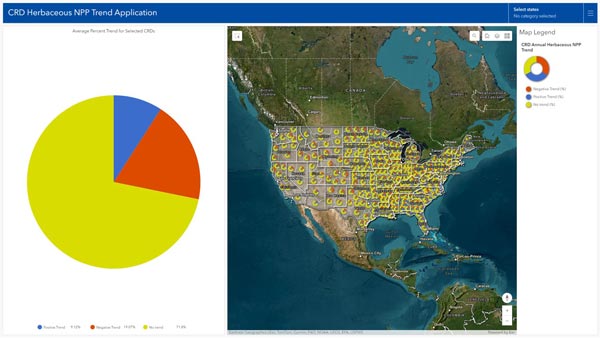
Herbaceous NPP Trends App
Herbaceous NPP 7-year (2015-2021) trends summarized by HUC8 and CRD spatial units.
Data summarizing the percent of area in each HUC8 and CRD exhibiting a significant seven year trend (Positive, negative, p<0.10) in annual average herbaceous NPP (gC/m2/yr) or no trend (p>=0.10).
View Data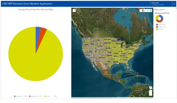
NPP Deviation from Weather
Deviation of NPP trends from what would be expected based on regional weather (2015-2021).
Comparison is based on a statistical model trained using data for 2001-2021. The deviation may be associated with management changes, but this inference has not yet been studied. Results available at watershed (HUC8) and Crop Reporting District (CRD) geographic scales.
View Data