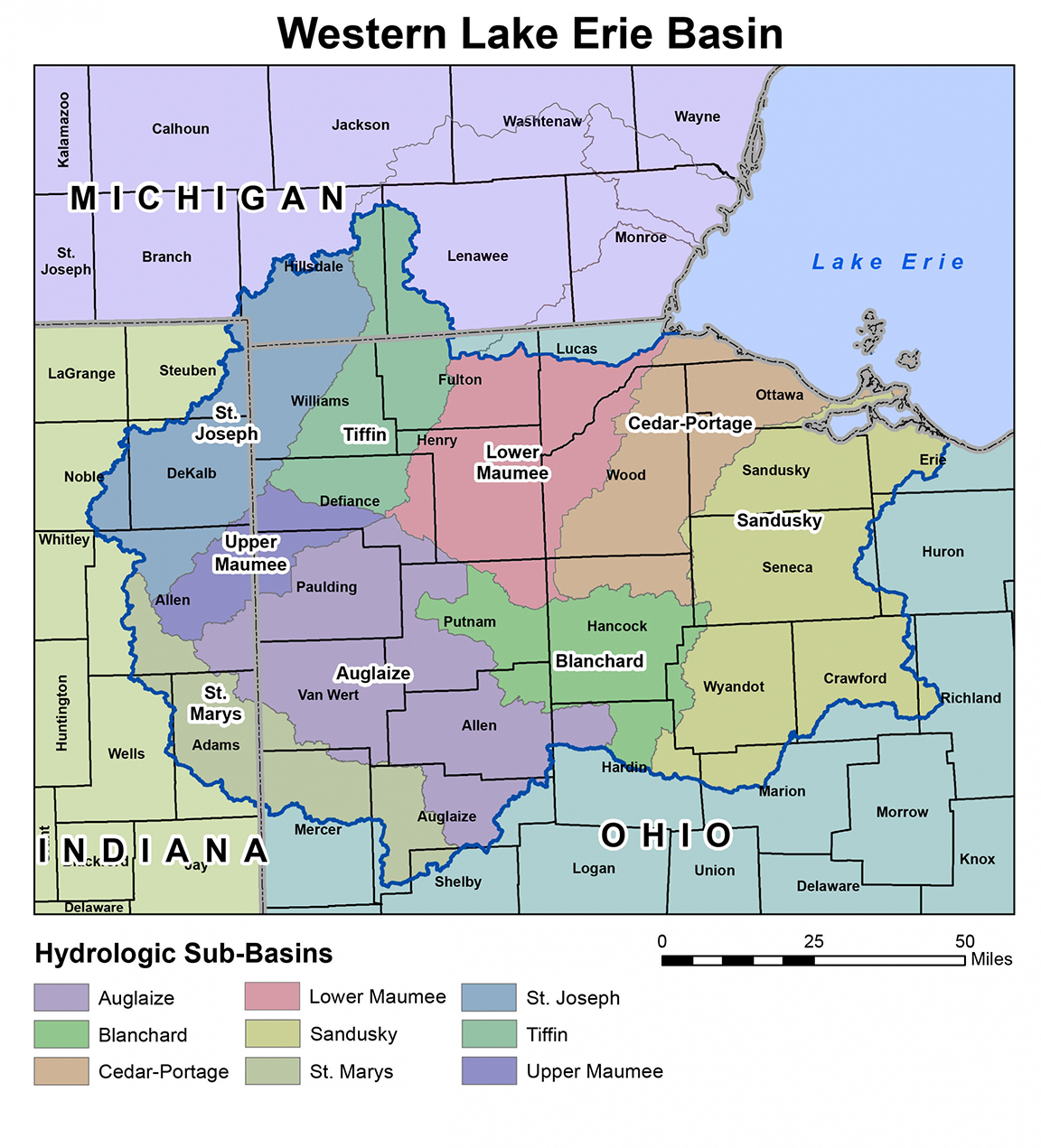
Cropland - Adoption of Climate-Smart Agricultural Practices

Adoption of Climate-Smart Agricultural Practices

Data are available for the adoption of cover crops and conservation tillage. Remote-sensing derived, CONUS-wide cropland data for the adoption of two important conservation practices (cover crops and reduced tillage).

Data are currently available for the years 2015-2021. All data are available at the watershed (HUC8) and Crop Reporting District (CRD) geographic scales.


Explore the Climate-Smart Data Applications

Cover Crop Image
Cover Crop
The extent of cover crop adoption on row crops across CONUS (the lower 48 states).

Remote-sensing derived, CONUS-wide cropland data for the adoption of cover crops. Data are currently available for the years 2015-2021. All data are available at the watershed (HUC8) and Crop Reporting District (CRD) geographic scales.

View Data
Tillage Image
Tillage

The extent of reduced tillage adoption on row crops across CONUS (the lower 48 states).

Remote-sensing derived, CONUS-wide cropland data for the adoption of various forms of tillage. Data are currently available for the years 2015-2021. All data are available at the watershed (HUC8) and Crop Reporting District (CRD) geographic scales.

View Data
Crop Rotation
Crop Rotation

The extent of cover crops and reduced tillage adoption by crop rotation for row crops across CONUS (the lower 48 states).

Remote-sensing derived, CONUS-wide cropland data for the adoption of conservation practices by crop rotation. Data are currently available for the years 2015-2021. All data are available at the watershed (HUC8) and Crop Reporting District (CRD) geographic scales.

View Data