Industry Resources
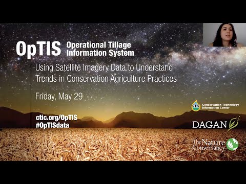
OpTIS
Data that Drives
Conservation Solutions
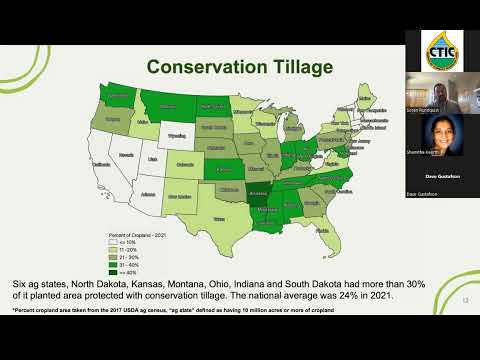
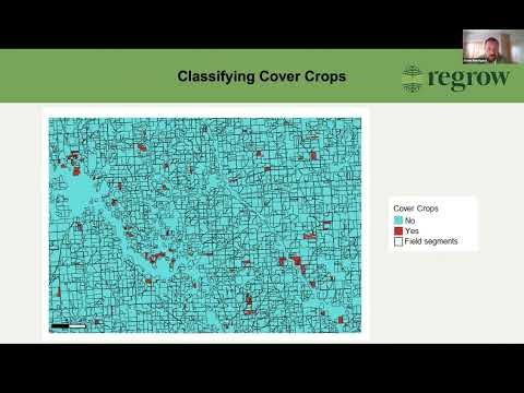
The Operational Tillage Information System (OpTIS) uses satellite imagery to track annual trends in tillage and cover crop adoption, yielding data that can assist scientists, policy makers and carbon trading managers.

National Cover Crop Survey
The SARE/ASTA/CTIC National Cover Crop Survey is the leading resource for practice trends, attitudinal studies of farmers and advisers, and analysis on cover crop adoption and use. Learn what farmers and farm advisers cite as leading barriers to more widespread and consistent planting of cover crops.
Legacy Data National Survey
Since 1982, the Conservation Technology Information Center’s (CTIC) National Crop Residue Management Survey (CRM) is the only survey in the U.S. designed to measure and track the type of tillage used by crop at the county level through personal observation of field conditions at half-mile or mile intervals.
All Industry Resources