OpTIS 4.0
CTIC has partnered with Regrow and The Nature Conservancy on the development, testing and application of the Operational Tillage Information System (OpTIS), an automated system to map tillage, residue cover, winter cover, and soil health practices using remote sensing data. While OpTIS calculations are performed at the farm-field scale using publicly available data, the privacy of individual producers is fully protected by reporting only spatially-aggregated results at regional and watershed scales.
OpTIS-based data are currently available for the years 2015 through 2021. The Version 4.0 dataset released in September 2023 uses updated algorithms for croplands in all lower 48 states (CONUS). The data are presented in the context of a two-year crop rotation with options to review by the previous and following cash crop for both tillage and cover crops. Both the OpTIS and DNDC pages include charts and maps to further enhance identification of trends and opportunities to promote the adoption of conservation practices. As with previous releases, all data are undergoing various forms of peer review and may be updated in the future.
Later this month (April 2024), CTIC will be releasing a new satellite-driven tool from Regrow that provides vegetation health and productivity data for all CONUS grasslands. These data will be of keen interest to anyone interested in grazing, as well as the ecosystem services that such lands provide.
Some of the organizations that have supported the development of OpTIS have included USDA, NASA, Bayer, Corteva, Enterprise, Ecosystem Services Market Consortium, Foundation for Food & Agriculture Research, Howard G. Buffet Foundation, John Deere, Monsanto, The Mosaic Company, The Nature Conservancy, Simplot, Soil Health Partnership, Syngenta, Walmart Foundation, and Walton Family Foundation.
On 27-Sep-2023, CTIC, TNC and Regrow Ag hosted 'OpTIS 4.0: New National Baseline Data for Conservation Ag' a webinar covering the new OpTIS 4.0 data. Watch the webinar below:
How to Use the OpTIS Visualization Tool
What is OpTIS?
Want to learn more?
Visit our OpTIS information page.
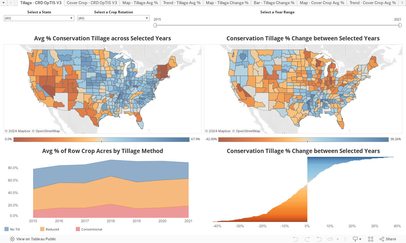
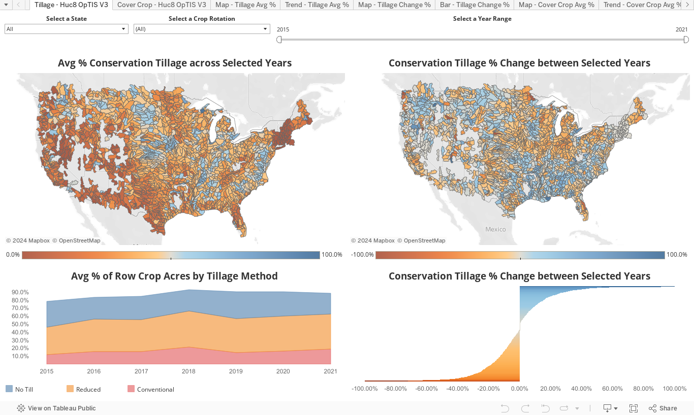
OpTIS Tillage
View OpTIS data results using the Tableau functions below. You can view results from either CRD or HUC8 boundaries by selecting the corresponding tabs below.
NOTE: If tables do not load properly please refresh the page.
NOTE: If tables do not load properly please refresh the page.